Online Maps
Interactive maps for NDEP
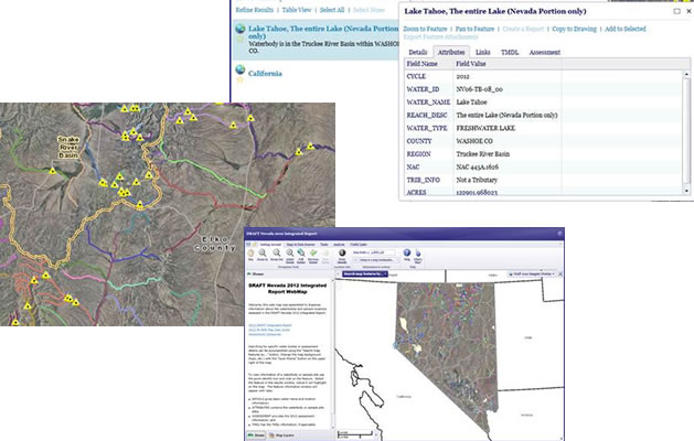
An Interactive Map Application is an easy way for you to directly view NDEP's GIS data. These applications grab spatial data dynamically from NDEP's central geodatabase and present it to you in a web browser interface. Our maps are designed in the Geocortex and Web AppBuilder for ArcGIS applications. All maps are mobile device compatible. Click on the link below to access our maps:
ACCESS THE NDEP WEB MAPS HERE
PLEASE NOTE: By accessing this website and/or data contained within the databases, you accept the disclaimer. A copy of the disclaimer can be found here.